
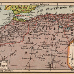
Algérie, Tunisie et Maroc
Permalink
https://digital.library.illinois.edu/items/492ef7d0-e946-0133-1d3d-0050569601ca-c
This item is in the public domain.
Descriptive Information
| Title | Algérie, Tunisie et Maroc |
| Date | 1890 |
| Dimensions | 8.5 x 13.5 cm |
| Place of Publication | Geneva (Switzerland) |
| Cartographic Scale | 1:20,000,000 |
| Notes | Post card size map. |
| Coverage-Spatial | Africa, North |
| Genre | Maps |
| Source | Edition Jeheber, Petit Atlas de Poche Universel, Geneva. |
| Physical Location | Professor Thomas Bassett Personal Collection |
| Bibliography | No. 9 in the collection |
| Map ID | afm0003187 |
| Rights | No Copyright - United States |
| Rights Description | This item is in the public domain. |
| Collection Title | Maps of Africa to 1900 |
| Repository | Rare Book & Manuscript Library |
| Type | Cartographic material |
| Collection | Maps of Africa to 1900 |
Download Options
|
Algérie, Tunisie et Maroc |
Contact us
for questions and to provide feedback.