
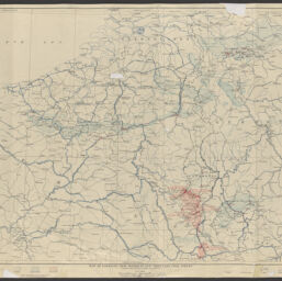
Map of Lorraine iron districts and tributary coal fields
Permalink
https://digital.library.illinois.edu/items/4acfe490-c24f-013d-2ea7-02d0d7bfd6e4-e
No Copyright - United States
Descriptive Information
| Title | Map of Lorraine iron districts and tributary coal fields |
| Creator | Geological Survey (U.S.) |
| Contributor | Brooks, Alfred H. (Alfred Hulse), 1871-1924 |
| Scale | 1:600,000 |
| Coordinates | (E 1°--E 6°/N 52°--N 48°) |
| Place of Publication | Washington (D.C.) |
| Publisher | U.S. Geological Survey |
| Date of Publication | 1919 |
| Extent | 1 map : color |
| Dimensions | 66 x 87 cm |
| Notes |
|
| Coverage-Spatial | |
| Language | English |
| Subject | |
| Genre | |
| Rights Description | No Copyright - United States |
| Type | Cartographic material |
| Repository | Map Library |
| Local Bib ID | 9995552672730589 |
| Collection Title | World War I Maps |
| Collection | World War I Maps |
Download Options
|
Map of Lorraine iron districts and tributary coal fields |
Contact us
for questions and to provide feedback.