


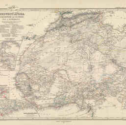
Nordwest-Afrika im Maassstabe von 1:12,500,000.
Permalink
https://digital.library.illinois.edu/items/4b0624f0-e946-0133-1d3d-0050569601ca-c
This item is in the public domain.
Descriptive Information
| Title | Nordwest-Afrika im Maassstabe von 1:12,500,000. |
| Creator | Petermann, Von A. |
| Date | 1879 |
| Dimensions | 34.5 x 42 cm |
| Place of Publication | Gotha (Germany) |
| Cartographic Scale | 1:12,500,000 |
| Notes |
|
| Coverage-Spatial | Africa, West |
| Genre | Maps |
| Source | Stieler's Hand_Atlas, Gotha, No 69 |
| Physical Location | Professor Thomas Bassett Personal Collection |
| Map ID | afm0003087 |
| Rights | No Copyright - United States |
| Rights Description | This item is in the public domain. |
| Collection Title | Maps of Africa to 1900 |
| Repository | Rare Book & Manuscript Library |
| Type | Cartographic material |
| Collection | Maps of Africa to 1900 |
Download Options
|
Nordwest-Afrika im Maassstabe von 1:12,500,000. |
Contact us
for questions and to provide feedback.