


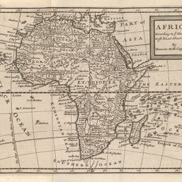
Africa
Permalink
https://digital.library.illinois.edu/items/4b32e860-e946-0133-1d3d-0050569601ca-5
This item is in the public domain.
Descriptive Information
| Title | Africa |
| Creator | Moll, Herman, -1732 |
| Date | 1714 |
| Dimensions | 17.8 x 25.5 cm |
| Place of Publication | England |
| Cartographic Scale | 1:55,000,000 |
| Coverage-Spatial | Africa |
| Genre | Maps |
| Source | Atlas geographus, V. 4, between pp. 32-33. |
| Physical Location | rbx |
| Map No. in Bassett and Scheven Bibliography | 63 |
| Call Number | X910M735A |
| Map ID | afm0000063 |
| Rights | No Copyright - United States |
| Rights Description | This item is in the public domain. |
| Collection Title | Maps of Africa to 1900 |
| Repository | Rare Book & Manuscript Library |
| Type | Cartographic material |
| Collection | Maps of Africa to 1900 |
Download Options
Contact us
for questions and to provide feedback.