
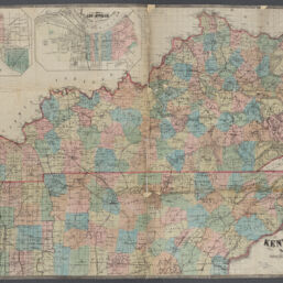
New map of Kentucky and Tennessee : from authentic reports of county surveyors throughout the states of Kentucky and Tennessee
Permalink
https://digital.library.illinois.edu/items/4b7cc870-0eca-013c-47d9-02d0d7bfd6e4-e
This item is in the public domain.
Descriptive Information
| Title | New map of Kentucky and Tennessee : from authentic reports of county surveyors throughout the states of Kentucky and Tennessee |
| Creator | Middleton, Strobridge & Co. |
| Scale | Scale approximately 1:750,000 |
| Place of Publication | Cincinnati (Ohio) |
| Publisher | Middleton, Strobridge & Co. |
| Date of Publication | 1862 |
| Extent | 1 map : color |
| Dimensions | 79 x 122 cm |
| Notes |
|
| Coverage-Spatial | |
| Language | English |
| Associated Entities | Campbell & Barlow |
| Genre | Maps |
| Rights | No Copyright - United States |
| Rights Description | This item is in the public domain. |
| Type | Cartographic material |
| Repository | Map Library |
| Local Bib ID | 99160420212205899 |
| Collection Title | Civil War Maps |
| Collection | Civil War Maps |
Download Options
|
New map of Kentucky and Tennessee : from authentic reports of county surveyors throughout the states of Kentucky and Tennessee |
Contact us
for questions and to provide feedback.