
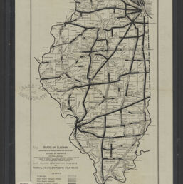
Map showing construction progress on federal aid and state bond issue roads
Permalink
https://digital.library.illinois.edu/items/4b9f5730-9935-013c-4aba-02d0d7bfd6e4-2
No Copyright - United States
Descriptive Information
| Title | Map showing construction progress on federal aid and state bond issue roads |
| Alternative Title |
|
| Creator | Illinois. Division of Highways |
| Scale | Scale not given |
| Coordinates | W 91°30ʹ--W 87°30ʹ/N 42°30ʹ--N 36°58ʹ |
| Place of Publication | Springfield (Ill.) |
| Publisher | Illinois. Division of Highways |
| Date of Publication | 1924 |
| Extent | 1 map |
| Dimensions | 38 x 23 cm |
| Notes |
|
| Coverage-Spatial | Illinois |
| Language | English |
| Subject | Roads--Design and construction |
| Genre | |
| Rights | No Copyright - United States |
| Type | Cartographic material |
| Repository | Map Library |
| Local Bib ID | 99823783012205899 |
| Collection Title | 1920s Maps |
| Collection | 1920s Maps |
Download Options
|
99823783012205899-001 | |

|
99823783012205899-002 |
Contact us
for questions and to provide feedback.