


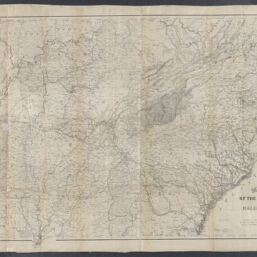
Military map showing the marches of the United States forces under command of Maj. Genl. W.T. Sherman, U.S.A. during the years 1863, 1864, 1865
Permalink
https://digital.library.illinois.edu/items/4bac1c50-0eca-013c-47d9-02d0d7bfd6e4-0
This item is in the public domain.
Descriptive Information
| Title | Military map showing the marches of the United States forces under command of Maj. Genl. W.T. Sherman, U.S.A. during the years 1863, 1864, 1865 |
| Creator | Kossak, William |
| Scale | Scale 1:1,267,200. 1 in. to 20 miles |
| Coordinates | W 92°--W 76°/N 38°--N 31° |
| Place of Publication |
|
| Publisher | |
| Date of Publication | 1865 |
| Extent | 1 map |
| Dimensions | 67 x 116 cm |
| Notes |
|
| Coverage-Spatial | Southern States |
| Language | English |
| Subject | |
| Associated Entities | |
| Genre | Maps |
| Rights | No Copyright - United States |
| Rights Description | This item is in the public domain. |
| Type | Cartographic material |
| Repository | Map Library |
| Local Bib ID | 99162254512205899 |
| Collection Title | Civil War Maps |
| Collection | Civil War Maps |
Download Options
|
Military map showing the marches of the United States forces under command of Maj. Genl. W.T. Sherman, U.S.A. during the years 1863, 1864, 1865 |
Contact us
for questions and to provide feedback.