
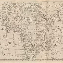
An Accurate Map of Africa
Permalink
https://digital.library.illinois.edu/items/4badb9e0-e946-0133-1d3d-0050569601ca-0
This item is in the public domain.
Descriptive Information
| Title | An Accurate Map of Africa |
| Creator | Brookes, R. (Richard), active 1721-1763 |
| Date | 1766 |
| Dimensions | 19.1 x 28.6 cm |
| Place of Publication | England |
| Cartographic Scale | 1:47,000,000 |
| Coverage-Spatial | Africa |
| Genre | Maps |
| Source | General Gazetteer, adjacent to "Africa" entry. |
| Physical Location | rbx |
| Map No. in Bassett and Scheven Bibliography | 98 |
| Call Number | X910_3B79G1766 |
| Map ID | afm0000098 |
| Rights | No Copyright - United States |
| Rights Description | This item is in the public domain. |
| Collection Title | Maps of Africa to 1900 |
| Repository | Rare Book & Manuscript Library |
| Type | Cartographic material |
| Collection | Maps of Africa to 1900 |
Download Options
|
An Accurate Map of Africa |
Contact us
for questions and to provide feedback.