


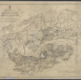
Topographical map of the approaches and defences of Knoxville, Tennessee : shewing the positions occupied by the United States & Confederate forces during the siege
Permalink
https://digital.library.illinois.edu/items/4bb04c10-0eca-013c-47d9-02d0d7bfd6e4-9
This item is in the public domain.
Descriptive Information
| Title | Topographical map of the approaches and defences of Knoxville, Tennessee : shewing the positions occupied by the United States & Confederate forces during the siege |
| Creator | Poe, O. M. (Orlando Metcalfe), 1832-1895 |
| Scale | Scale approximately 1:10,000 |
| Place of Publication |
|
| Publisher | |
| Date of Publication | 1864 |
| Extent | 1 map : color |
| Dimensions | 66 x 75 cm |
| Notes |
|
| Coverage-Spatial | Knoxville Region (Tenn.) |
| Language | English |
| Subject | |
| Associated Entities | United States. Army. Corps of Engineers |
| Genre | Maps |
| Rights | No Copyright - United States |
| Rights Description | This item is in the public domain. |
| Type | Cartographic material |
| Repository | Map Library |
| Local Bib ID | 99162290612205899 |
| Collection Title | Civil War Maps |
| Collection | Civil War Maps |
Download Options
|
Topographical map of the approaches and defences of Knoxville, Tennessee : shewing the positions occupied by the United States & Confederate forces during the siege |
Contact us
for questions and to provide feedback.