
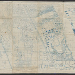
Maneuver sketch, Fort Sheridan and vicinity
Maneuver sketch, Fort Sheridan and vicinity / compiled March, 1926, at headquarters, 2d. Infantry from existing maps and surveys under direction [of] Colonel P.L. Miles ; E.J. Houck, captain, 2d. Inf. ; M.H. Wright, sgt., Co. "B," 2d. Inf., d'ftsm'n
Permalink
https://digital.library.illinois.edu/items/4bb9ea30-9935-013c-4aba-02d0d7bfd6e4-c
No Copyright - United States
Descriptive Information
| Title | Maneuver sketch, Fort Sheridan and vicinity |
| Alternative Title | Maneuver sketch, Fort Sheridan and vicinity / compiled March, 1926, at headquarters, 2d. Infantry from existing maps and surveys under direction [of] Colonel P.L. Miles ; E.J. Houck, captain, 2d. Inf. ; M.H. Wright, sgt., Co. "B," 2d. Inf., d'ftsm'n |
| Creator | Houck, E. J. |
| Scale | Scale 1:5,280 |
| Coordinates | W 87°48′38″/N 42°12′45″ |
| Place of Publication | Illinois |
| Date of Publication | 1926-1941 |
| Extent | 1 map : photocopy |
| Dimensions | 62 x 90 cm |
| Notes |
|
| Coverage-Spatial | |
| Language | English |
| Subject | History |
| Associated Entities | Wright, M. H. |
| Genre | Maps |
| Rights | No Copyright - United States |
| Type | Cartographic material |
| Repository | Map Library |
| Local Bib ID | 99955395523005899 |
| Collection Title | 1920s Maps |
| Collection | 1920s Maps |
Download Options
|
Maneuver sketch, Fort Sheridan and vicinity |
Contact us
for questions and to provide feedback.