
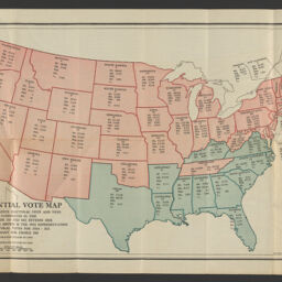
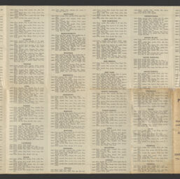
Presidential vote map showing at a glance the votes cast for the candidates in 1920 and electoral vote, also detail vote since 1900
Permalink
https://digital.library.illinois.edu/items/4bbf3450-9935-013c-4aba-02d0d7bfd6e4-6
No Copyright - United States
Descriptive Information
| Title | Presidential vote map showing at a glance the votes cast for the candidates in 1920 and electoral vote, also detail vote since 1900 |
| Alternative Title |
|
| Creator | National Economic Plans, Inc. |
| Scale | Scale approximately 1:10,000,000 |
| Coordinates | W 124°50ʹ--W 66°53ʹ/N 49°23ʹ--N 24°23ʹ |
| Place of Publication |
|
| Publisher | |
| Date of Publication | 1924 |
| Extent | 1 map : color |
| Dimensions | 30 x 49 cm, folded to 18 x 9 cm |
| Notes |
|
| Coverage-Spatial | United States |
| Language | English |
| Subject | |
| Associated Entities | Providence Institution for Savings (Providence, R.I.) |
| Genre | |
| Rights | No Copyright - United States |
| Type | Cartographic material |
| Repository | Map Library |
| Local Bib ID | 99955453622205899 |
| Collection Title | 1920s Maps |
| Collection | 1920s Maps |
Download Options
|
99955453622205899-001 | |
|
99955453622205899-002 |
Contact us
for questions and to provide feedback.