
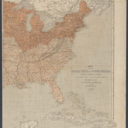
Map of the United States of North America, Upper & Lower Canada, New Brunswick, Nova Scotia & British Columbia. Mexico, Cuba, Jamaica, St. Domingo and the Bahama Islands / by T. Ettling
Permalink
https://digital.library.illinois.edu/items/4bc3a110-0eca-013c-47d9-02d0d7bfd6e4-3
This item is in the public domain.
Descriptive Information
| Title | Map of the United States of North America, Upper & Lower Canada, New Brunswick, Nova Scotia & British Columbia. Mexico, Cuba, Jamaica, St. Domingo and the Bahama Islands / by T. Ettling |
| Creator | Ettling, Theodor, 1823- |
| Scale | Scale approximately 1:6,000,000 |
| Place of Publication |
|
| Publisher | |
| Date of Publication | 1861 |
| Extent | 1 map on 2 sheets : color |
| Dimensions | 69 x 95 cm, sheets 75 x 52 cm |
| Notes |
|
| Coverage-Spatial | United States |
| Language | English |
| Genre | Maps |
| Rights | No Copyright - United States |
| Rights Description | This item is in the public domain. |
| Type | Cartographic material |
| Repository | Map Library |
| Local Bib ID | 99398859512205899 |
| Collection Title | Civil War Maps |
| Collection | Civil War Maps |
Download Options
|
99398859512205899-001 | |

|
99398859512205899-002 |
Contact us
for questions and to provide feedback.