
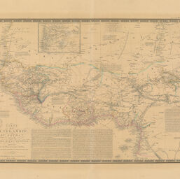
Carte de la Sénegambie du Soudan et de la Guinée Septrionale
Permalink
https://digital.library.illinois.edu/items/4bd087e0-e946-0133-1d3d-0050569601ca-0
This item is in the public domain.
Descriptive Information
| Title | Carte de la Sénegambie du Soudan et de la Guinée Septrionale |
| Creator | Brué, Adrien Hubert, 1786-1832 |
| Date | 1834 |
| Dimensions | 36.5 x 51.5 cm |
| Place of Publication | Paris (France) |
| Cartographic Scale | 1:8,400,000 |
| Coverage-Spatial | Africa, West |
| Genre | Maps |
| Source | Atlas Universel de Géographie Physique, Politique, Ancienne & Moderne. Paris, ca. 1842 |
| Physical Location | Professor Thomas Bassett Personal Collection |
| Bibliography | Rumsey Collection No. 2741.057 |
| Map ID | afm0003055 |
| Rights | No Copyright - United States |
| Rights Description | This item is in the public domain. |
| Collection Title | Maps of Africa to 1900 |
| Repository | Rare Book & Manuscript Library |
| Type | Cartographic material |
| Collection | Maps of Africa to 1900 |
Download Options
|
Carte de la Sénegambie du Soudan et de la Guinée Septrionale |
Contact us
for questions and to provide feedback.