
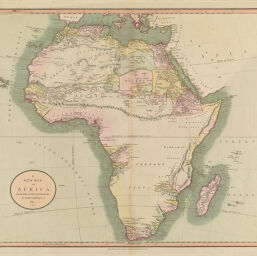
A New Map of Africa, the Latest Authorities, by John Cary, Engraver, 1811.
Permalink
https://digital.library.illinois.edu/items/4c01be70-e946-0133-1d3d-0050569601ca-e
This item is in the public domain.
Descriptive Information
| Title | A New Map of Africa, the Latest Authorities, by John Cary, Engraver, 1811. |
| Creator | Cary, John, approximately 1754-1835 |
| Date | 1811 |
| Dimensions | 47 x 53 cm |
| Place of Publication | London (England) |
| Cartographic Scale | 1:17,500,000 |
| Coverage-Spatial | Africa |
| Genre | Maps |
| Source | Cary's New Universal Atlas, London, 1808. |
| Physical Location | Professor Thomas Bassett Personal Collection |
| Bibliography |
|
| Map ID | afm0003032 |
| Rights | No Copyright - United States |
| Rights Description | This item is in the public domain. |
| Collection Title | Maps of Africa to 1900 |
| Repository | Rare Book & Manuscript Library |
| Type | Cartographic material |
| Collection | Maps of Africa to 1900 |
Download Options
|
A New Map of Africa, the Latest Authorities, by John Cary, Engraver, 1811. |
Contact us
for questions and to provide feedback.