
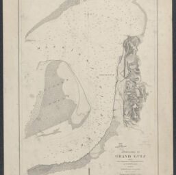
Approaches to Grand Gulf, Miss. / From a topographical & hydrographical survey by F.H. Gerdes, Assistant, assigned by A.D. Bache, Supdt, U.S. Coast Survey, to act under orders of Rear Admiral D.D. Porter, U.S. Navy, commanding Mississippi Squadron
Permalink
https://digital.library.illinois.edu/items/4c2b7570-0eca-013c-47d9-02d0d7bfd6e4-f
This item is in the public domain.
Descriptive Information
| Title | Approaches to Grand Gulf, Miss. / From a topographical & hydrographical survey by F.H. Gerdes, Assistant, assigned by A.D. Bache, Supdt, U.S. Coast Survey, to act under orders of Rear Admiral D.D. Porter, U.S. Navy, commanding Mississippi Squadron |
| Creator | Gerdes, F. H. |
| Scale | Scale 1:10,000 |
| Date of Publication | 1864 |
| Extent | 1 map, |
| Dimensions | 57 x 39 cm |
| Notes |
|
| Coverage-Spatial | |
| Language | English |
| Genre | |
| Rights | No Copyright - United States |
| Rights Description | This item is in the public domain. |
| Type | Cartographic material |
| Repository | Map Library |
| Local Bib ID | 99955337983005899 |
| Collection Title | Civil War Maps |
| Collection | Civil War Maps |
Download Options
|
Approaches to Grand Gulf, Miss. / From a topographical & hydrographical survey by F.H. Gerdes, Assistant, assigned by A.D. Bache, Supdt, U.S. Coast Survey, to act under orders of Rear Admiral D.D. Porter, U.S. Navy, commanding Mississippi Squadron |
Contact us
for questions and to provide feedback.