
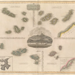
Atlantic Islands
Permalink
https://digital.library.illinois.edu/items/4c872e30-e946-0133-1d3d-0050569601ca-7
This item is in the public domain.
Descriptive Information
| Title | Atlantic Islands |
| Creator | John Thomson and Co. |
| Date | 1814 |
| Dimensions | 50 x 58.9 cm |
| Cartographic Scale | Various scales |
| Coverage-Spatial | Islands--Africa |
| Genre | Maps |
| Source | New General Atlas, plate 50. |
| Physical Location | rbx |
| Map No. in Bassett and Scheven Bibliography | 2408 |
| Call Number | XF_912J613N |
| Map ID | afm0002408 |
| Rights | No Copyright - United States |
| Rights Description | This item is in the public domain. |
| Collection Title | Maps of Africa to 1900 |
| Repository | Rare Book & Manuscript Library |
| Type | Cartographic material |
| Collection | Maps of Africa to 1900 |
Download Options
|
Atlantic Islands |
Contact us
for questions and to provide feedback.