
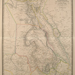
Carte du Cours du Nil, Comprenant l'Egypte, la Nubie, l'Abyssinie et la Mer Rouge
Permalink
https://digital.library.illinois.edu/items/4c8dd740-e946-0133-1d3d-0050569601ca-d
This item is in the public domain.
Descriptive Information
| Title | Carte du Cours du Nil, Comprenant l'Egypte, la Nubie, l'Abyssinie et la Mer Rouge |
| Creator | Andriveau-Goujon, J. |
| Date | 1832 |
| Dimensions | 50 x 38.2 cm |
| Cartographic Scale | 1:5,900,000 |
| Coverage-Spatial | Africa |
| Genre | Maps |
| Color | Hand colored |
| Technique | Etched or engraved |
| Source | Atlas classique, plate 34. |
| Physical Location | stx |
| Map No. in Bassett and Scheven Bibliography | 177 |
| Call Number | F_911AN2A |
| Map ID | afm0000177 |
| Rights | No Copyright - United States |
| Rights Description | This item is in the public domain. |
| Collection Title | Maps of Africa to 1900 |
| Repository | Rare Book & Manuscript Library |
| Type | Cartographic material |
| Collection | Maps of Africa to 1900 |
Download Options
|
Carte du Cours du Nil, Comprenant l'Egypte, la Nubie, l'Abyssinie et la Mer Rouge |
Contact us
for questions and to provide feedback.