
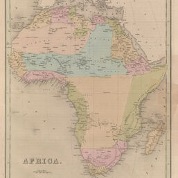
Africa
Permalink
https://digital.library.illinois.edu/items/4ccdb480-e946-0133-1d3d-0050569601ca-d
This item is in the public domain.
Descriptive Information
| Title | Africa |
| Creator | Bradford, T. G. (Thomas Gamaliel), 1802-1887 |
| Date | 1841 |
| Dimensions | 36 x 29 cm |
| Place of Publication | United States |
| Cartographic Scale | 1:27,300,000 |
| Coverage-Spatial | Africa |
| Genre | Maps |
| Color | Hand colored |
| Technique | Etched or engraved |
| Source | Universal Illustrated Atlas, plate 49. |
| Physical Location | ihlc, maos |
| Map No. in Bassett and Scheven Bibliography | 196 |
| Call Number | F_912B72U |
| Map ID | afm0000196 |
| Rights | No Copyright - United States |
| Rights Description | This item is in the public domain. |
| Collection Title | Maps of Africa to 1900 |
| Repository | Rare Book & Manuscript Library |
| Type | Cartographic material |
| Collection | Maps of Africa to 1900 |
Download Options
Contact us
for questions and to provide feedback.