
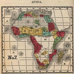
Africa
Permalink
https://digital.library.illinois.edu/items/4cdd62c0-e946-0133-1d3d-0050569601ca-1
This item is in the public domain.
Descriptive Information
| Title | Africa |
| Creator | Mather, J. H. (Joseph Higgins), 1789-1878 |
| Date | 1850 |
| Dimensions | 8 x 8.7 cm |
| Place of Publication | United States |
| Cartographic Scale | 1:110,000,000 |
| Coverage-Spatial | Africa |
| Genre | Maps |
| Source | Manual of Geography, plate 7. |
| Physical Location | rbx |
| Map No. in Bassett and Scheven Bibliography | 212 |
| Call Number | X910M42M1850 |
| Map ID | afm0000212 |
| Rights | No Copyright - United States |
| Rights Description | This item is in the public domain. |
| Collection Title | Maps of Africa to 1900 |
| Repository | Rare Book & Manuscript Library |
| Type | Cartographic material |
| Collection | Maps of Africa to 1900 |
Download Options
Contact us
for questions and to provide feedback.