


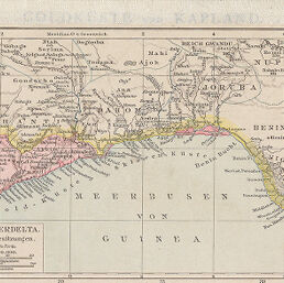
Goldküste und Nigerdelta
Permalink
https://digital.library.illinois.edu/items/4de38df0-e946-0133-1d3d-0050569601ca-7
This item is in the public domain.
Descriptive Information
| Title | Goldküste und Nigerdelta |
| Creator | Andree, Richard |
| Date | 1881 |
| Dimensions | 9.7 x 18 cm |
| Place of Publication | Germany |
| Cartographic Scale | 1:8,000,000 |
| Notes | Same page as ID No. 2255, 1692. |
| Coverage-Spatial | Africa, West |
| Genre | Maps |
| Color | Printed color |
| Technique | Lithography |
| Source | Allgemeiner Handatlas, p. 96. |
| Physical Location | maos |
| Map No. in Bassett and Scheven Bibliography | 2254 |
| Call Number | F_912AN2A1881 |
| Map ID | afm0002254 |
| Rights | No Copyright - United States |
| Rights Description | This item is in the public domain. |
| Collection Title | Maps of Africa to 1900 |
| Repository | Rare Book & Manuscript Library |
| Type | Cartographic material |
| Collection | Maps of Africa to 1900 |
Download Options
|
Goldküste und Nigerdelta |
Contact us
for questions and to provide feedback.