
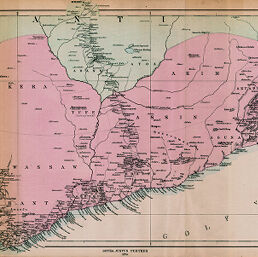
Specialkarte der Länder an der Goldküste in Innern bis Kumassi, Englisch-Afrikanischer Kriegsschauplatz in 1874.
Permalink
https://digital.library.illinois.edu/items/4df2f120-e946-0133-1d3d-0050569601ca-7
This item is in the public domain.
Descriptive Information
| Title | Specialkarte der Länder an der Goldküste in Innern bis Kumassi, Englisch-Afrikanischer Kriegsschauplatz in 1874. |
| Creator | Domann, B. (Bruno) |
| Date | 1874 |
| Dimensions | 24.5 x 65 cm |
| Place of Publication | Germany |
| Cartographic Scale | 1:800,000 |
| Notes | Relief shown by hachures. |
| Coverage-Spatial | Gold Coast |
| Subject | |
| Genre | Maps |
| Language | German |
| Color | Hand colored |
| Source | Petermanns geographische Mitteilungen, V. 20, plate 2. |
| Physical Location | stx |
| Map No. in Bassett and Scheven Bibliography | 2241 |
| Call Number | Q_910_5PE |
| Map ID | afm0002241 |
| Rights | No Copyright - United States |
| Rights Description | This item is in the public domain. |
| Collection Title | Maps of Africa to 1900 |
| Repository | Rare Book & Manuscript Library |
| Type | Cartographic material |
| Collection | Maps of Africa to 1900 |
Download Options
|
Specialkarte der Länder an der Goldküste in Innern bis Kumassi, Englisch-Afrikanischer Kriegsschauplatz in 1874. |
Contact us
for questions and to provide feedback.