
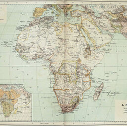
Afrika (Politische Übersicht)
Permalink
https://digital.library.illinois.edu/items/4e29e7b0-e946-0133-1d3d-0050569601ca-f
This item is in the public domain.
Descriptive Information
| Title | Afrika (Politische Übersicht) |
| Creator | Freytag, Gustav, 1852-1938 |
| Date | 1889 |
| Dimensions | 34 x 47.5 cm |
| Place of Publication | Austria |
| Cartographic Scale | 1:30,000,000 |
| Notes | Includes 1 inset map: Völkerkarte von Afrika. |
| Coverage-Spatial | Africa |
| Subject | |
| Genre | Maps |
| Language | German |
| Color | Printed color |
| Technique | Lithography |
| Source | Die erde in karten und bildern : Handatlas in 63 karten nebst 125 bogen text mit 1000 illustrationen, p. 372. |
| Physical Location | stx |
| Map No. in Bassett and Scheven Bibliography | 370 |
| Call Number | Q_910ER27 |
| Map ID | afm0000370 |
| Rights | No Copyright - United States |
| Rights Description | This item is in the public domain. |
| Collection Title | Maps of Africa to 1900 |
| Repository | Rare Book & Manuscript Library |
| Type | Cartographic material |
| Collection | Maps of Africa to 1900 |
Download Options
|
Afrika (Politische Übersicht) |
Contact us
for questions and to provide feedback.