
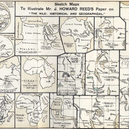
Drawings and graphics to Illustrate Mr. J. Howard Reed's Paper on “The Nile: Historical and Geographical”
Permalink
https://digital.library.illinois.edu/items/4e505700-e946-0133-1d3d-0050569601ca-3
This item is in the public domain.
Descriptive Information
| Title | Drawings and graphics to Illustrate Mr. J. Howard Reed's Paper on “The Nile: Historical and Geographical” |
| Creator | Reed, J. Howard |
| Date | 1890 |
| Extent | 14 maps on 1 sheet |
| Dimensions | 21.7 x 29.8 cm |
| Place of Publication | England |
| Cartographic Scale | Various scales |
| Notes | Dates of coverage from 900 B.C. to 1890. |
| Coverage-Spatial | Nile River |
| Subject | |
| Genre | Maps |
| Language | English |
| Color | Printed color |
| Technique | Lithography |
| Source | The Journal of the Manchester Geographical Society, V. 6, between pp. 344-345. |
| Physical Location | stx |
| Map No. in Bassett and Scheven Bibliography | 385 |
| Call Number | 910_6MA |
| Map ID | afm0000385 |
| Rights | No Copyright - United States |
| Rights Description | This item is in the public domain. |
| Collection Title | Maps of Africa to 1900 |
| Repository | Rare Book & Manuscript Library |
| Type | Cartographic material |
| Collection | Maps of Africa to 1900 |
Download Options
|
Drawings and graphics to Illustrate Mr. J. Howard Reed's Paper on “The Nile: Historical and Geographical” |
Contact us
for questions and to provide feedback.