
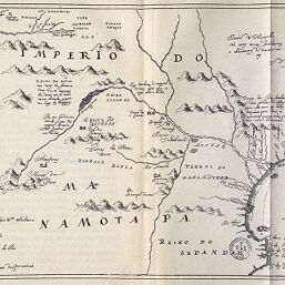
Réproduction d'une Carte Manuscrite Inédite de la Fin Du XVIIe Siècle Établissant les droits Historiques du Portugal en Afrique qui se Trouve à la Section de Géographie de la Bibliothèque Nationale.
Permalink
https://digital.library.illinois.edu/items/4e584ef0-e946-0133-1d3d-0050569601ca-5
This item is in the public domain.
Descriptive Information
| Title | Réproduction d'une Carte Manuscrite Inédite de la Fin Du XVIIe Siècle Établissant les droits Historiques du Portugal en Afrique qui se Trouve à la Section de Géographie de la Bibliothèque Nationale. |
| Creator | Revue Géographique Internationale |
| Date | 1890 |
| Dimensions | 16.4 x 25.6 cm |
| Place of Publication | France |
| Cartographic Scale | Scale not given |
| Notes | Relief shown pictorially. |
| Coverage-Spatial | Africa |
| Subject | |
| Genre | Maps |
| Language | French |
| Color | Bitonal |
| Technique | Lithography |
| Source | Revue de géographie, V. 26, between pp. 240-241. |
| Physical Location | stx |
| Map No. in Bassett and Scheven Bibliography | 386 |
| Call Number | 910_5RE |
| Map ID | afm0000386 |
| Rights | No Copyright - United States |
| Rights Description | This item is in the public domain. |
| Collection Title | Maps of Africa to 1900 |
| Repository | Rare Book & Manuscript Library |
| Type | Cartographic material |
| Collection | Maps of Africa to 1900 |
Download Options
|
Réproduction d'une Carte Manuscrite Inédite de la Fin Du XVIIe Siècle Établissant les droits Historiques du Portugal en Afrique qui se Trouve à la Section de Géographie de la Bibliothèque Nationale. |
Contact us
for questions and to provide feedback.