
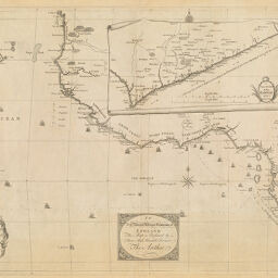
New & Correct Map of the Coast of Africa
Permalink
https://digital.library.illinois.edu/items/4ed921f0-e946-0133-1d3d-0050569601ca-8
This item is in the public domain.
Descriptive Information
| Title | New & Correct Map of the Coast of Africa |
| Date | 1744 |
| Dimensions | 47.8 x 65.5 cm |
| Cartographic Scale | 1:7,660,000 |
| Coverage-Spatial | Africa, West |
| Genre | Maps |
| Source | Loose sheet |
| Physical Location | rbx |
| Map No. in Bassett and Scheven Bibliography | 2150 |
| Call Number | G88351744_N4 |
| Map ID | afm0002150 |
| Rights | No Copyright - United States |
| Rights Description | This item is in the public domain. |
| Collection Title | Maps of Africa to 1900 |
| Repository | Rare Book & Manuscript Library |
| Type | Cartographic material |
| Collection | Maps of Africa to 1900 |
Download Options
|
New & Correct Map of the Coast of Africa |
Contact us
for questions and to provide feedback.