
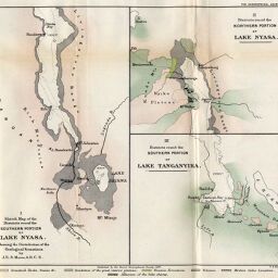
Sketch Map of the Districts round the Southern portion of Lake Nyasa District round the northern portion of Lake Nyasa Districts round the southern portion of Lake Tanganyika.
Permalink
https://digital.library.illinois.edu/items/4eef2b90-e946-0133-1d3d-0050569601ca-c
This item is in the public domain.
Descriptive Information
| Title | Sketch Map of the Districts round the Southern portion of Lake Nyasa District round the northern portion of Lake Nyasa Districts round the southern portion of Lake Tanganyika. |
| Creator | Moore, J.E.S. |
| Date | 1897 |
| Extent | 3 maps on 1 sheet |
| Dimensions | 23.7 x 27.8 cm |
| Place of Publication | England |
| Cartographic Scale | Scales not given |
| Notes | Showing the distribution of the geological formations. |
| Coverage-Spatial | Great Lakes (Africa) |
| Subject | |
| Genre | Maps |
| Language | English |
| Color | Printed color |
| Technique | Lithography |
| Source | The Geographical Journal, V. 10, between pp. 348-349. |
| Physical Location | stx |
| Map No. in Bassett and Scheven Bibliography | 446 |
| Call Number | 910_5GJ |
| Map ID | afm0000446 |
| Rights | No Copyright - United States |
| Rights Description | This item is in the public domain. |
| Collection Title | Maps of Africa to 1900 |
| Repository | Rare Book & Manuscript Library |
| Type | Cartographic material |
| Collection | Maps of Africa to 1900 |
Download Options
|
Sketch Map of the Districts round the Southern portion of Lake Nyasa District round the northern portion of Lake Nyasa Districts round the southern portion of Lake Tanganyika. |
Contact us
for questions and to provide feedback.