
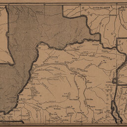
Carte du Congo Rectifiée
Permalink
https://digital.library.illinois.edu/items/4f92c820-e946-0133-1d3d-0050569601ca-d
This item is in the public domain.
Descriptive Information
| Title | Carte du Congo Rectifiée |
| Creator | Revue Géographique Internationale |
| Date | 1894 |
| Dimensions | 18.5 x 25.5 cm |
| Cartographic Scale | 1:10,250,000 |
| Coverage-Spatial | Africa, Central |
| Genre | Maps |
| Source | Revue géographique internationale, V. 19, p. 214. |
| Physical Location | stos |
| Map No. in Bassett and Scheven Bibliography | 2071 |
| Call Number | 910_5REGI |
| Map ID | afm0002071 |
| Rights | No Copyright - United States |
| Rights Description | This item is in the public domain. |
| Collection Title | Maps of Africa to 1900 |
| Repository | Rare Book & Manuscript Library |
| Type | Cartographic material |
| Collection | Maps of Africa to 1900 |
Download Options
|
Carte du Congo Rectifiée |
Contact us
for questions and to provide feedback.