
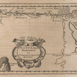
Egypti LibiE marmaricE et CyrenaicE Tractvs maritimus
Permalink
https://digital.library.illinois.edu/items/4f99b3f0-e946-0133-1d3d-0050569601ca-d
This item is in the public domain.
Descriptive Information
| Title | Egypti LibiE marmaricE et CyrenaicE Tractvs maritimus |
| Creator | Morisot, Claude-Barthélemy, 1592-1661 |
| Date | 1643 |
| Dimensions | 13 x 17 cm |
| Place of Publication | France |
| Cartographic Scale | 1:12,500,000 |
| Coverage-Spatial | Africa, North |
| Genre | Maps |
| Source | Orbis maritimi, p. 279. |
| Physical Location | rbx |
| Map No. in Bassett and Scheven Bibliography | 504 |
| Call Number | IUQ01702 |
| Map ID | afm0000504 |
| Rights | No Copyright - United States |
| Rights Description | This item is in the public domain. |
| Collection Title | Maps of Africa to 1900 |
| Repository | Rare Book & Manuscript Library |
| Type | Cartographic material |
| Collection | Maps of Africa to 1900 |
Download Options
|
Egypti LibiE marmaricE et CyrenaicE Tractvs maritimus |
Contact us
for questions and to provide feedback.