
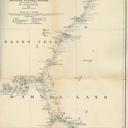
Originalkarte der im Auftrage des Deutschen Goldsyndikates in den Jahren 1888-89...(Nördlicher Theil)
Permalink
https://digital.library.illinois.edu/items/4fee3fc0-e946-0133-1d3d-0050569601ca-0
This item is in the public domain.
Descriptive Information
| Title | Originalkarte der im Auftrage des Deutschen Goldsyndikates in den Jahren 1888-89...(Nördlicher Theil) |
| Creator | Gürich, Georg, 1859-1938 |
| Date | 1891 |
| Dimensions | 37.4 x 28.9 cm |
| Place of Publication | Germany |
| Cartographic Scale | 1:500,000 |
| Notes | Relief show by contours. |
| Coverage-Spatial | Namibia |
| Subject | |
| Genre | Maps |
| Language | German |
| Color | Bitonal |
| Source | Mitteilungen Jahresbericht der Geographischen Gesellschaft in Hamburg, V. 10, after p. 216. |
| Physical Location | stx |
| Map No. in Bassett and Scheven Bibliography | 2038 |
| Call Number | 910_6GEO |
| Map ID | afm0002038 |
| Rights | No Copyright - United States |
| Rights Description | This item is in the public domain. |
| Collection Title | Maps of Africa to 1900 |
| Repository | Rare Book & Manuscript Library |
| Type | Cartographic material |
| Collection | Maps of Africa to 1900 |
Download Options
|
Originalkarte der im Auftrage des Deutschen Goldsyndikates in den Jahren 1888-89...(Nördlicher Theil) |
Contact us
for questions and to provide feedback.