
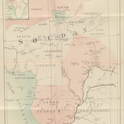
Carte du Congo Français.
Permalink
https://digital.library.illinois.edu/items/4ff51500-e946-0133-1d3d-0050569601ca-5
This item is in the public domain.
Descriptive Information
| Title | Carte du Congo Français. |
| Creator | Nebout, Albert, 1862-1940 |
| Date | 1892 |
| Dimensions | 43.2 x 32.7 cm |
| Cartographic Scale | 1:7,750,000 |
| Coverage-Spatial | Africa, Central |
| Genre | Maps |
| Color | Printed color |
| Technique | Lithography |
| Source | Bulletin de l’année, V. 13-14, back pocket. |
| Physical Location | stx |
| Map No. in Bassett and Scheven Bibliography | 2047 |
| Call Number | 910_6SOI |
| Map ID | afm0002047 |
| Rights | No Copyright - United States |
| Rights Description | This item is in the public domain. |
| Collection Title | Maps of Africa to 1900 |
| Repository | Rare Book & Manuscript Library |
| Type | Cartographic material |
| Collection | Maps of Africa to 1900 |
Download Options
|
Carte du Congo Français. |
Contact us
for questions and to provide feedback.