
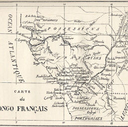
Carte du Congo Français
Permalink
https://digital.library.illinois.edu/items/50b8b690-e946-0133-1d3d-0050569601ca-b
This item is in the public domain.
Descriptive Information
| Title | Carte du Congo Français |
| Creator | Decazes, M. |
| Date | 1888 |
| Dimensions | 14.3 x 17.9 cm |
| Cartographic Scale | 1:10,000,000 |
| Coverage-Spatial | Africa, French-speaking Equatorial |
| Subject | |
| Genre | Maps |
| Language | French |
| Color | Bitonal |
| Technique | Lithography |
| Source | Bulletin de l’année, V. 10, between pp. 40-41. |
| Physical Location | stx |
| Map No. in Bassett and Scheven Bibliography | 1992 |
| Call Number | 910_6SOI |
| Map ID | afm0001992 |
| Rights | No Copyright - United States |
| Rights Description | This item is in the public domain. |
| Collection Title | Maps of Africa to 1900 |
| Repository | Rare Book & Manuscript Library |
| Type | Cartographic material |
| Collection | Maps of Africa to 1900 |
Download Options
|
Carte du Congo Français |
Contact us
for questions and to provide feedback.