


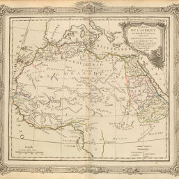
Partie de Afrique
Permalink
https://digital.library.illinois.edu/items/51436f20-e946-0133-1d3d-0050569601ca-4
This item is in the public domain.
Descriptive Information
| Title | Partie de Afrique |
| Creator | Brion de la Tour, Louis, 1743-1803 |
| Date | 1772 |
| Dimensions | 22.8 x 25.5 cm |
| Place of Publication | France |
| Cartographic Scale | 1:25,000,000 |
| Coverage-Spatial | Africa, North |
| Genre | Maps |
| Source | Atlas général, plate 46. |
| Physical Location | rbx |
| Map No. in Bassett and Scheven Bibliography | 631 |
| Call Number | XQ_912B77A1772 |
| Map ID | afm0000631 |
| Rights | No Copyright - United States |
| Rights Description | This item is in the public domain. |
| Collection Title | Maps of Africa to 1900 |
| Repository | Rare Book & Manuscript Library |
| Type | Cartographic material |
| Collection | Maps of Africa to 1900 |
Download Options
|
Partie de Afrique |
Contact us
for questions and to provide feedback.