
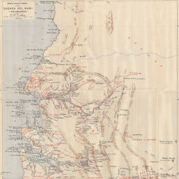
Exploraciones en la Cuenca del Muni y sus Cercanías
Permalink
https://digital.library.illinois.edu/items/5181c430-e946-0133-1d3d-0050569601ca-4
This item is in the public domain.
Descriptive Information
| Title | Exploraciones en la Cuenca del Muni y sus Cercanías |
| Creator | Iradier-Bulfy, D. Manuel |
| Date | 1878 |
| Dimensions | 27.6 x 27.4 cm |
| Cartographic Scale | 1:1,000,000 |
| Notes | Part of a larger plate (11x17) with ID Nos. 1898, 1899, 1901, 1902, 1903, and one non-Africa map. |
| Coverage-Spatial | Africa, Central |
| Genre | Maps |
| Color | Printed color |
| Technique | Lithography and aquatint |
| Source | Boletín de la Real Sociedad Geográfica, V. 4, No. 1, between pp. 356-357. |
| Physical Location | stx |
| Map No. in Bassett and Scheven Bibliography | 1900 |
| Call Number | 910_6SOM |
| Map ID | afm0001900 |
| Rights | No Copyright - United States |
| Rights Description | This item is in the public domain. |
| Collection Title | Maps of Africa to 1900 |
| Repository | Rare Book & Manuscript Library |
| Type | Cartographic material |
| Collection | Maps of Africa to 1900 |
Download Options
|
Exploraciones en la Cuenca del Muni y sus Cercanías |
Contact us
for questions and to provide feedback.