
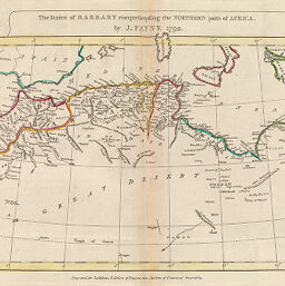
States of Barbary comprehending the Northern parts of Africa
Permalink
https://digital.library.illinois.edu/items/5191bb50-e946-0133-1d3d-0050569601ca-3
This item is in the public domain.
Descriptive Information
| Title | States of Barbary comprehending the Northern parts of Africa |
| Creator | Payne, John |
| Date | 1792 |
| Dimensions | 21 x 39.5 cm |
| Place of Publication | England |
| Cartographic Scale | 1:11,800,000 |
| Coverage-Spatial | Africa, North |
| Genre | Maps |
| Source | Atlas, plate 10. |
| Physical Location | rbx |
| Map No. in Bassett and Scheven Bibliography | 651 |
| Call Number | XQ_912P29A |
| Map ID | afm0000651 |
| Rights | No Copyright - United States |
| Rights Description | This item is in the public domain. |
| Collection Title | Maps of Africa to 1900 |
| Repository | Rare Book & Manuscript Library |
| Type | Cartographic material |
| Collection | Maps of Africa to 1900 |
Download Options
|
States of Barbary comprehending the Northern parts of Africa |
Contact us
for questions and to provide feedback.