
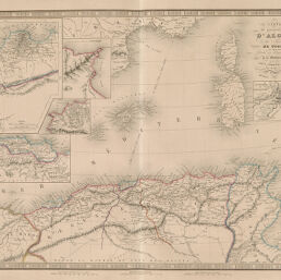
Carte du Gouvernement d'Alger de la Régence de Tunis...
Permalink
https://digital.library.illinois.edu/items/51f33cd0-e946-0133-1d3d-0050569601ca-7
This item is in the public domain.
Descriptive Information
| Title | Carte du Gouvernement d'Alger de la Régence de Tunis... |
| Creator | Andriveau-Goujon, J. |
| Date | 1837 |
| Dimensions | 38.1 x 50.3 cm |
| Place of Publication | France |
| Cartographic Scale | 1:3,300,000 |
| Notes | Cleaned with brush or eraser. |
| Coverage-Spatial | Africa, North |
| Genre | Maps |
| Color | Hand colored |
| Technique | Etched or engraved |
| Source | Atlas classique, plate 33. |
| Physical Location | stx |
| Map No. in Bassett and Scheven Bibliography | 687 |
| Call Number | F_911AN2A |
| Map ID | afm0000687 |
| Rights | No Copyright - United States |
| Rights Description | This item is in the public domain. |
| Collection Title | Maps of Africa to 1900 |
| Repository | Rare Book & Manuscript Library |
| Type | Cartographic material |
| Collection | Maps of Africa to 1900 |
Download Options
|
Carte du Gouvernement d'Alger de la Régence de Tunis... |
Contact us
for questions and to provide feedback.