
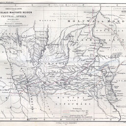
Originalkarte von Ladislaus Magyar's Reisen in Central_Afrika, 1850, 1851 u. 1855.
Permalink
https://digital.library.illinois.edu/items/5224d8b0-e946-0133-1d3d-0050569601ca-0
This item is in the public domain.
Descriptive Information
| Title | Originalkarte von Ladislaus Magyar's Reisen in Central_Afrika, 1850, 1851 u. 1855. |
| Creator | Petermann, A. (August), 1822-1878 |
| Date | 1860 |
| Dimensions | 19 x 24.4 cm |
| Cartographic Scale | 1:4,000,000 |
| Notes | Relief shown by contours and hachures. Paris meridian. |
| Coverage-Spatial | Congo (Democratic Republic) |
| Subject | |
| Genre | Maps |
| Language | German |
| Color | Hand colored |
| Technique | Lithography |
| Source | Petermanns geographische Mitteilungen, V. 6, plate 10. |
| Physical Location | stx |
| Map No. in Bassett and Scheven Bibliography | 1848 |
| Call Number | Q_910_5PE |
| Map ID | afm0001848 |
| Rights | No Copyright - United States |
| Rights Description | This item is in the public domain. |
| Collection Title | Maps of Africa to 1900 |
| Repository | Rare Book & Manuscript Library |
| Type | Cartographic material |
| Collection | Maps of Africa to 1900 |
Download Options
|
Originalkarte von Ladislaus Magyar's Reisen in Central_Afrika, 1850, 1851 u. 1855. |
Contact us
for questions and to provide feedback.