
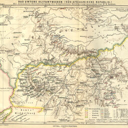
Das Untere Olifantbecken (Süd-Afrikanische Republik.)...
Permalink
https://digital.library.illinois.edu/items/5317c060-e946-0133-1d3d-0050569601ca-0
This item is in the public domain.
Descriptive Information
| Title | Das Untere Olifantbecken (Süd-Afrikanische Republik.)... |
| Creator | Raddatz, H. |
| Date | 1886 |
| Dimensions | 24.2 x 30.8 cm |
| Place of Publication | Germany |
| Cartographic Scale | 1:600,000 |
| Notes | Relief shown by shaded contours. |
| Coverage-Spatial | Olifants River (South Africa) |
| Subject | |
| Genre | Maps |
| Language | German |
| Color | Printed color |
| Technique | Lithography |
| Source | Petermanns geographische Mitteilungen, V. 32, plate 4. |
| Physical Location | stx |
| Map No. in Bassett and Scheven Bibliography | 1724 |
| Call Number | Q_910_5PE |
| Map ID | afm0001724 |
| Rights | No Copyright - United States |
| Rights Description | This item is in the public domain. |
| Collection Title | Maps of Africa to 1900 |
| Repository | Rare Book & Manuscript Library |
| Type | Cartographic material |
| Collection | Maps of Africa to 1900 |
Download Options
|
Das Untere Olifantbecken (Süd-Afrikanische Republik.)... |
Contact us
for questions and to provide feedback.