
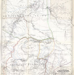
Originalkarte von C. Mauch's reisen im Innern von Süd-Afrika zwischen Potchefstroom und Zambesi, 1865-1869…
Permalink
https://digital.library.illinois.edu/items/53b0c820-e946-0133-1d3d-0050569601ca-7
This item is in the public domain.
Descriptive Information
| Title | Originalkarte von C. Mauch's reisen im Innern von Süd-Afrika zwischen Potchefstroom und Zambesi, 1865-1869… |
| Date | 1870 |
| Dimensions | 52 x 42.5 cm |
| Cartographic Scale | 1:2,000,000 |
| Notes | Relief shown by hachures. |
| Coverage-Spatial | Africa, Southern |
| Subject | |
| Genre | Maps |
| Language | German |
| Color | Hand colored |
| Technique | Lithography |
| Source | Petermanns geographische Mitteilungen, V. 16, plate 1. |
| Physical Location | stx |
| Map No. in Bassett and Scheven Bibliography | 1672 |
| Call Number | Q_910_5PE |
| Map ID | afm0001672 |
| Rights | No Copyright - United States |
| Rights Description | This item is in the public domain. |
| Collection Title | Maps of Africa to 1900 |
| Repository | Rare Book & Manuscript Library |
| Type | Cartographic material |
| Collection | Maps of Africa to 1900 |
Download Options
|
Originalkarte von C. Mauch's reisen im Innern von Süd-Afrika zwischen Potchefstroom und Zambesi, 1865-1869… |
Contact us
for questions and to provide feedback.