
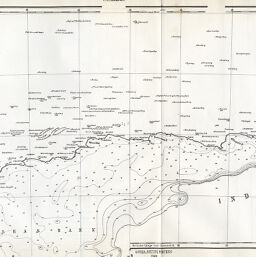
Übersicht der Triconometrischen & Nautischen Aufnahmen in Kaplande bis 1867
Permalink
https://digital.library.illinois.edu/items/53b86ea0-e946-0133-1d3d-0050569601ca-8
This item is in the public domain.
Descriptive Information
| Title | Übersicht der Triconometrischen & Nautischen Aufnahmen in Kaplande bis 1867 |
| Creator | Petermann, A. (August), 1822-1878 |
| Date | 1867 |
| Dimensions | 24.5 x 62.3 cm |
| Cartographic Scale | 1:1,800,000 |
| Notes | Depths shown by contours and soundings. Includes 1 inset map showing a continuation of the Agulhas Bank. |
| Coverage-Spatial | South Africa |
| Subject | |
| Genre | Maps |
| Language | German |
| Color | Bitonal |
| Technique | Lithography |
| Source | Petermanns geographische Mitteilungen, V. 14, plate 3. |
| Physical Location | stx |
| Map No. in Bassett and Scheven Bibliography | 1666 |
| Call Number | Q_910_5PE |
| Map ID | afm0001666 |
| Rights | No Copyright - United States |
| Rights Description | This item is in the public domain. |
| Collection Title | Maps of Africa to 1900 |
| Repository | Rare Book & Manuscript Library |
| Type | Cartographic material |
| Collection | Maps of Africa to 1900 |
Download Options
|
Übersicht der Triconometrischen & Nautischen Aufnahmen in Kaplande bis 1867 |
Contact us
for questions and to provide feedback.