
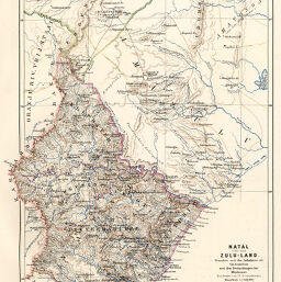
Natal und das Zulu-Land
Permalink
https://digital.library.illinois.edu/items/53c16370-e946-0133-1d3d-0050569601ca-0
This item is in the public domain.
Descriptive Information
| Title | Natal und das Zulu-Land |
| Creator | Grundemann, R. (Reinhold), 1836-1924 |
| Date | 1867 |
| Dimensions | 31.4 x 21.6 cm |
| Cartographic Scale | 1:1,500,000 |
| Notes | Printed and hand colored. |
| Coverage-Spatial | Africa, Southern |
| Genre | Maps |
| Color | Hand colored |
| Technique | Lithography |
| Source | Petermanns geographische Mitteilungen, V. 13, plate 8. |
| Physical Location | stx |
| Map No. in Bassett and Scheven Bibliography | 1665 |
| Call Number | Q_910_5PE |
| Map ID | afm0001665 |
| Rights | No Copyright - United States |
| Rights Description | This item is in the public domain. |
| Collection Title | Maps of Africa to 1900 |
| Repository | Rare Book & Manuscript Library |
| Type | Cartographic material |
| Collection | Maps of Africa to 1900 |
Download Options
|
Natal und das Zulu-Land |
Contact us
for questions and to provide feedback.