
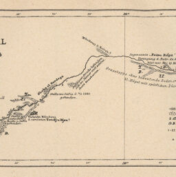
Karte des Bahr el Ghasal vom Mokren el Bohur bis z. Bahr el Arab aufgenommen im Januar U. März bis Juni 1881 von E. Marno im Ägypt. Dampfer Borden
Permalink
https://digital.library.illinois.edu/items/5422edb0-e946-0133-1d3d-0050569601ca-5
This item is in the public domain.
Descriptive Information
| Title | Karte des Bahr el Ghasal vom Mokren el Bohur bis z. Bahr el Arab aufgenommen im Januar U. März bis Juni 1881 von E. Marno im Ägypt. Dampfer Borden |
| Creator | Marno, Ernst, 1844-1883 |
| Date | 1882 |
| Dimensions | 8.1 x 19.4 cm |
| Place of Publication | Austria |
| Cartographic Scale | 1:1,000,000 |
| Coverage-Spatial | Africa, North |
| Genre | Maps |
| Color | Bitonal |
| Technique | Lithography |
| Source | Mitteilungen der Österreichischen Geographischen Gesellschaft, V. 25, after p. 490. |
| Physical Location | stx |
| Map No. in Bassett and Scheven Bibliography | 854 |
| Call Number | 910_5GEOW |
| Map ID | afm0000854 |
| Rights | No Copyright - United States |
| Rights Description | This item is in the public domain. |
| Collection Title | Maps of Africa to 1900 |
| Repository | Rare Book & Manuscript Library |
| Type | Cartographic material |
| Collection | Maps of Africa to 1900 |
Download Options
|
Karte des Bahr el Ghasal vom Mokren el Bohur bis z. Bahr el Arab aufgenommen im Januar U. März bis Juni 1881 von E. Marno im Ägypt. Dampfer Borden |
Contact us
for questions and to provide feedback.