
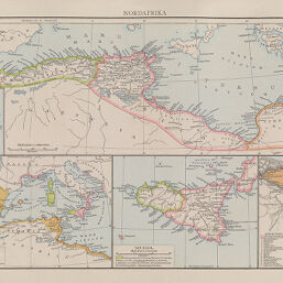
Nordafrika
Permalink
https://digital.library.illinois.edu/items/546ff140-e946-0133-1d3d-0050569601ca-5
This item is in the public domain.
Descriptive Information
| Title | Nordafrika |
| Creator | Andree, Richard |
| Date | 1886 |
| Dimensions | 23 x 36 cm |
| Place of Publication | Germany |
| Cartographic Scale | 1:9,000,000 |
| Notes | On a page with four other maps. |
| Coverage-Spatial | Africa, North |
| Genre | Maps |
| Color | Printed color |
| Technique | Lithography |
| Source | Allgemeiner historischer Handatlas [cartographic material] in sechsundneunzig Karten mit erläuterndem Text ausgeführt von der Geographischen Anstalt von Velhagen & Klasing in Leipzig unter Leitung von Dr. Richard Andree, p. 15. |
| Physical Location | stx |
| Map No. in Bassett and Scheven Bibliography | 882 |
| Call Number | F_912D83A |
| Map ID | afm0000882 |
| Rights | No Copyright - United States |
| Rights Description | This item is in the public domain. |
| Collection Title | Maps of Africa to 1900 |
| Repository | Rare Book & Manuscript Library |
| Type | Cartographic material |
| Collection | Maps of Africa to 1900 |
Download Options
|
Nordafrika |
Contact us
for questions and to provide feedback.