
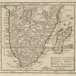
Congo, Angola, Cafres, Monoemugi, Monomotapa, Zanguebar, and Madagascar
Permalink
https://digital.library.illinois.edu/items/54a87960-e946-0133-1d3d-0050569601ca-4
This item is in the public domain.
Descriptive Information
| Title | Congo, Angola, Cafres, Monoemugi, Monomotapa, Zanguebar, and Madagascar |
| Creator | Moll, Herman, -1732 |
| Date | 1701 |
| Dimensions | 17 x 19 cm |
| Place of Publication | England |
| Cartographic Scale | 1:50,000,000 |
| Coverage-Spatial | Africa, Southern |
| Genre | Maps |
| Source | System of Geography, Part II, p. 102. |
| Physical Location | rbx |
| Map No. in Bassett and Scheven Bibliography | 1586 |
| Call Number | XQ_910M735S |
| Map ID | afm0001586 |
| Rights | No Copyright - United States |
| Rights Description | This item is in the public domain. |
| Collection Title | Maps of Africa to 1900 |
| Repository | Rare Book & Manuscript Library |
| Type | Cartographic material |
| Collection | Maps of Africa to 1900 |
Download Options
|
Congo, Angola, Cafres, Monoemugi, Monomotapa, Zanguebar, and Madagascar |
Contact us
for questions and to provide feedback.