
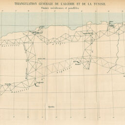
Triangulation Général de l'Algérie et de la Tunisie.
Permalink
https://digital.library.illinois.edu/items/55488cc0-e946-0133-1d3d-0050569601ca-b
This item is in the public domain.
Descriptive Information
| Title | Triangulation Général de l'Algérie et de la Tunisie. |
| Date | 1891 |
| Dimensions | 20.8 x 45.3 cm |
| Place of Publication | France |
| Cartographic Scale | 1:3,500,000 |
| Notes | Needs repair. |
| Coverage-Spatial | Africa, North |
| Genre | Maps |
| Color | Printed color |
| Technique | Lithography |
| Source | Bulletin de la Société de géographie, ser. 7, V. 12, between pp. 260-261. |
| Physical Location | stx |
| Map No. in Bassett and Scheven Bibliography | 946 |
| Call Number | 910_6SOGEASER_7 |
| Map ID | afm0000946 |
| Rights | No Copyright - United States |
| Rights Description | This item is in the public domain. |
| Collection Title | Maps of Africa to 1900 |
| Repository | Rare Book & Manuscript Library |
| Type | Cartographic material |
| Collection | Maps of Africa to 1900 |
Download Options
|
Triangulation Général de l'Algérie et de la Tunisie. |
Contact us
for questions and to provide feedback.