
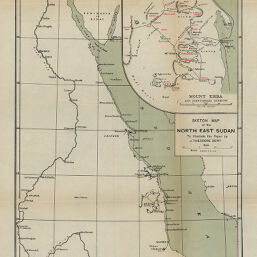
Sketch-Map of the North East Sudan
Permalink
https://digital.library.illinois.edu/items/55fe5420-e946-0133-1d3d-0050569601ca-2
This item is in the public domain.
Descriptive Information
| Title | Sketch-Map of the North East Sudan |
| Creator | Bent, J. Theodore (James Theodore), 1852-1897 |
| Date | 1896 |
| Dimensions | 35.4 x 28 cm |
| Place of Publication | Great Britain |
| Cartographic Scale | 1:1,000,000 |
| Notes | Inset of “Mount Erba and surrounding country.” |
| Coverage-Spatial | Africa, North |
| Genre | Maps |
| Source | The Geographical Journal, V. 11, between pp. 428-429. |
| Physical Location | stx |
| Map No. in Bassett and Scheven Bibliography | 983 |
| Call Number | 910_5GJ |
| Map ID | afm0000983 |
| Rights | No Copyright - United States |
| Rights Description | This item is in the public domain. |
| Collection Title | Maps of Africa to 1900 |
| Repository | Rare Book & Manuscript Library |
| Type | Cartographic material |
| Collection | Maps of Africa to 1900 |
Download Options
|
Sketch-Map of the North East Sudan |
Contact us
for questions and to provide feedback.