


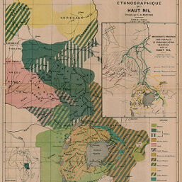
Carte Ethnographique du Haut Nil.
Permalink
https://digital.library.illinois.edu/items/565787e0-e946-0133-1d3d-0050569601ca-4
This item is in the public domain.
Descriptive Information
| Title | Carte Ethnographique du Haut Nil. |
| Creator | Martonne, Emmanuel de, 1873-1955 |
| Date | 1897 |
| Dimensions | 36.9 x 33.1 cm |
| Place of Publication | France |
| Cartographic Scale | 1:6,000,000 |
| Notes | Includes inset location map and map of “Mouvements principaux des peuples et fondations d'états indigènes dan le Haut Nil. |
| Coverage-Spatial | Great Lakes (Africa) |
| Subject | |
| Genre | Maps |
| Language | French |
| Color | Printed color |
| Technique | Lithography |
| Source | Annales de géographie : bulletin de la Société de géographie, V. 6, between pp. 60-61. |
| Physical Location | stx |
| Map No. in Bassett and Scheven Bibliography | 997 |
| Call Number | 910_5AN |
| Map ID | afm0000997 |
| Rights | No Copyright - United States |
| Rights Description | This item is in the public domain. |
| Collection Title | Maps of Africa to 1900 |
| Repository | Rare Book & Manuscript Library |
| Type | Cartographic material |
| Collection | Maps of Africa to 1900 |
Download Options
|
Carte Ethnographique du Haut Nil. |
Contact us
for questions and to provide feedback.