
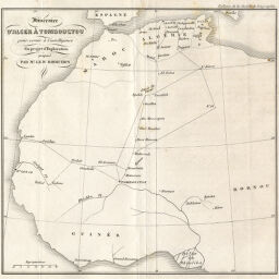
Itinéraire d'Alger à Tombouctou pour servir à l'intelligence du projet d'Exploration proposé par Mr. Le Dr. Bodichon
Permalink
https://digital.library.illinois.edu/items/56795cd0-e946-0133-1d3d-0050569601ca-6
This item is in the public domain.
Descriptive Information
| Title | Itinéraire d'Alger à Tombouctou pour servir à l'intelligence du projet d'Exploration proposé par Mr. Le Dr. Bodichon |
| Date | 1849 |
| Dimensions | 19.6 x 21.3 cm |
| Place of Publication | France |
| Cartographic Scale | 1:20,500,000 |
| Coverage-Spatial | Africa, West |
| Genre | Maps |
| Color | Bitonal |
| Technique | Lithography |
| Source | Bulletin de la Société de géographie, ser. 3, V. 12, after p. 112. |
| Physical Location | stx |
| Map No. in Bassett and Scheven Bibliography | 2206 |
| Call Number | 910_6SOGEASER_3 |
| Map ID | afm0002206 |
| Rights | No Copyright - United States |
| Rights Description | This item is in the public domain. |
| Collection Title | Maps of Africa to 1900 |
| Repository | Rare Book & Manuscript Library |
| Type | Cartographic material |
| Collection | Maps of Africa to 1900 |
Download Options
|
Itinéraire d'Alger à Tombouctou pour servir à l'intelligence du projet d'Exploration proposé par Mr. Le Dr. Bodichon |
Contact us
for questions and to provide feedback.