
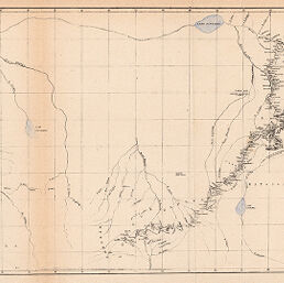
Reduction of Lieut. Cameron's preliminary map of his route & the adjacent country between Lake Tanganyika & Lovalè 1874-5
Permalink
https://digital.library.illinois.edu/items/56ebba60-e946-0133-1d3d-0050569601ca-0
This item is in the public domain.
Descriptive Information
| Title | Reduction of Lieut. Cameron's preliminary map of his route & the adjacent country between Lake Tanganyika & Lovalè 1874-5 |
| Creator | Società Geografica Italiana |
| Date | 1876 |
| Dimensions | 18.9 x 35.6 cm |
| Cartographic Scale | 1:6,000,000 |
| Coverage-Spatial | Africa, Central |
| Genre | Maps |
| Color | Printed color |
| Technique | Lithography |
| Source | Bollettino della Societa geografica italiana, ser. 2, V. 1, between pp. 78-79. |
| Physical Location | stx |
| Map No. in Bassett and Scheven Bibliography | 1881 |
| Call Number | 910_6SORSER_2 |
| Map ID | afm0001881 |
| Rights | No Copyright - United States |
| Rights Description | This item is in the public domain. |
| Collection Title | Maps of Africa to 1900 |
| Repository | Rare Book & Manuscript Library |
| Type | Cartographic material |
| Collection | Maps of Africa to 1900 |
Download Options
|
Reduction of Lieut. Cameron's preliminary map of his route & the adjacent country between Lake Tanganyika & Lovalè 1874-5 |
Contact us
for questions and to provide feedback.