
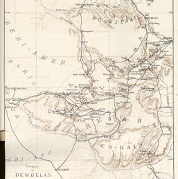
Croquis du Dembelas…
Permalink
https://digital.library.illinois.edu/items/5726eac0-e946-0133-1d3d-0050569601ca-c
This item is in the public domain.
Descriptive Information
| Title | Croquis du Dembelas… |
| Creator | Cesar, Airaghi |
| Date | 1895 |
| Dimensions | 29.4 x 21.3 cm |
| Place of Publication | Egypt |
| Cartographic Scale | 1:600,000 |
| Notes | Relief shown by hachures and contours. |
| Coverage-Spatial | Eritrea |
| Subject | |
| Genre | Maps |
| Language | French |
| Color | Printed color |
| Technique | Lithography |
| Source | Bulletin de la Société de géographie d'Eìgypte, V. 4, between pp. 486-487. |
| Physical Location | stos |
| Map No. in Bassett and Scheven Bibliography | 1479 |
| Call Number | 910_5SOCG |
| Map ID | afm0001479 |
| Rights | No Copyright - United States |
| Rights Description | This item is in the public domain. |
| Collection Title | Maps of Africa to 1900 |
| Repository | Rare Book & Manuscript Library |
| Type | Cartographic material |
| Collection | Maps of Africa to 1900 |
Download Options
|
Croquis du Dembelas… |
Contact us
for questions and to provide feedback.