
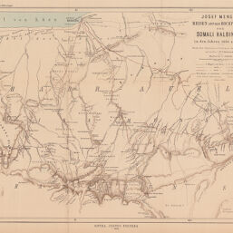
Josef Menges’ Reisen auf das Hochplateau der Somali Halbinsel in den Jahre 1884 und 1892...
Permalink
https://digital.library.illinois.edu/items/577efe00-e946-0133-1d3d-0050569601ca-9
This item is in the public domain.
Descriptive Information
| Title | Josef Menges’ Reisen auf das Hochplateau der Somali Halbinsel in den Jahre 1884 und 1892... |
| Creator | Hassenstein, Bruno |
| Date | 1894 |
| Dimensions | 34.6 x 45 cm |
| Place of Publication | Germany |
| Cartographic Scale | 1:300,000 |
| Coverage-Spatial | Africa, Eastern |
| Genre | Maps |
| Color | Printed color |
| Technique | Lithography |
| Source | Petermanns geographische Mitteilungen, V. 40, plate 16. |
| Physical Location | stx |
| Map No. in Bassett and Scheven Bibliography | 1464 |
| Call Number | Q_910_5PE |
| Map ID | afm0001464 |
| Rights | No Copyright - United States |
| Rights Description | This item is in the public domain. |
| Collection Title | Maps of Africa to 1900 |
| Repository | Rare Book & Manuscript Library |
| Type | Cartographic material |
| Collection | Maps of Africa to 1900 |
Download Options
|
Josef Menges’ Reisen auf das Hochplateau der Somali Halbinsel in den Jahre 1884 und 1892... |
Contact us
for questions and to provide feedback.